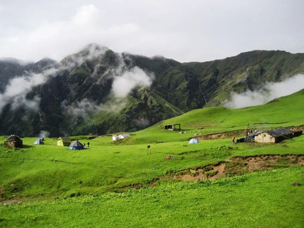
Picture a grassland the size of 300 football fields, sitting at nearly 12,000 feet, with Bandarpoonch and the Gangotri peaks close enough to feel touchable. That’s Dayara Bugyal on a clear October morning. No technical climbing, no glacier crossing – just forest, then suddenly, meadow. It’s why Indiahikes has run this trek since 2010 and still calls it one of its most-loved routes for beginners.
This guide pulls together the numbers people actually search for – distance, altitude, temperature by month, cost, and how it stacks up against Kedarkantha – sourced from trek operators, on-ground guides, and official trek pages. Where sources disagree (and on this trek, they often do), that’s flagged rather than papered over.
Where Is Dayara Bugyal Located?
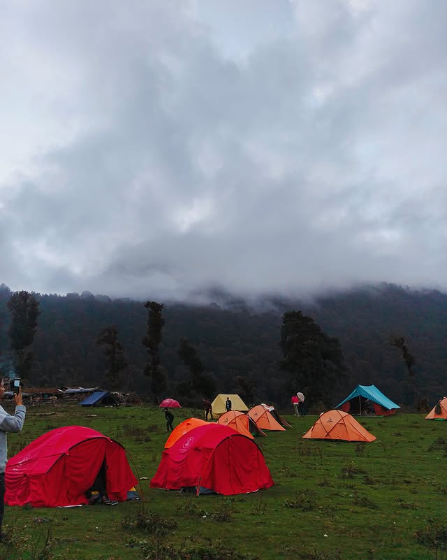
Dayara Bugyal sits in the Uttarkashi district of Uttarakhand, in the Garhwal Himalayas, roughly 45 km from Uttarkashi town and around 190 km from Dehradun. The meadow itself – a “bugyal,” Garhwali for a high-altitude alpine pasture – sits at around 11,800 ft and is reached from base villages like Raithal and Barsu, both connected by road from Dehradun and Rishikesh.
Two villages serve as the starting point:
- Raithal – the more commonly used base, and the one Indiahikes runs its Community Campus from.
- Barsu – higher up, shorter walk, less crowded.
Both trails converge above the treeline and end at the same meadow, so neither is really the “correct” choice. It comes down to how much forest walking you want versus how much time you have.
Dayara Bugyal Trek Distance
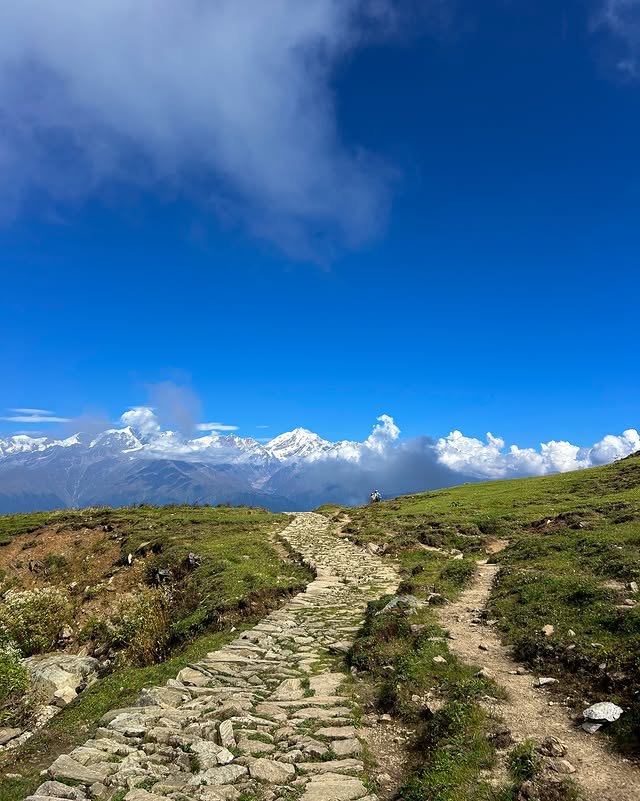
This is where the internet disagrees with itself. Ask five sources and you’ll get five different numbers, mostly because they’re counting different things – one-way versus round trip, Raithal versus Barsu, and whether side excursions to Bakaria Top or Barnala Tal are included.
| Source | Distance figure |
| Indiahikes (official 4-day trekking itinerary) | Around 21 km covered across 4 trekking days |
| Himalayan Hikers | About 10 km one way from Raithal, ~22 km round trip |
| JustWravel | 16–22 km total, depending on base village and route variation |
| Thrillophilia | 29 km total, summit at 12,000 ft |
The safest number to plan around is Indiahikes’ figure, since it’s tied to an actual published day-by-day itinerary rather than a rounded estimate: roughly 21 km over four trekking days, gaining about 4,688 ft from 7,142 ft in Raithal to 11,830 ft at Dayara Top. If you’re going from Barsu instead, expect the round trip to run shorter – Barsu sits higher, so there’s simply less ground to cover.
Distance from Nearby Base Villages
Dayara Bugyal has a few villages nearby it can be accessed from – Barsu is about 9 km away, Raithal about 11 km, and Bhatwari around 12 km.
Dayara Bugyal Trek Altitude and Height
The meadow’s highest walkable point, commonly called Bakaria Top or Dayara Top, is where the “height” figures cluster – though again, not everyone agrees on the exact number.
| Source | Altitude figure |
| Indiahikes (Day 4 itinerary) | 11,830 ft at Dayara Top |
| MyTravaly | 3,657 m (12,000 ft) at the highest point |
| The Searching Souls | 3,750 m at the meadow |
| Explurger | 3,639 m at the highest meadow point, ~3,800 m at Bakaria Top specifically |
Treat this as “roughly 11,800–12,000 ft” rather than a precise figure – trail conditions and exact turnaround points shift the number by a few hundred feet either way, and that’s normal for meadow treks where the “summit” isn’t a fixed peak.
For context, a bugyal is a natural grassy alpine slope, and Indiahikes defines the category more specifically: alpine pasture land that grows above roughly 10,500 ft and below 13,000 ft, always found above the treeline. Dayara sits comfortably in that band.
Best Time for Dayara Bugyal Trek
Here’s the thing that surprises first-timers: Dayara Bugyal can be trekked almost year-round, except during the monsoon. That’s roughly eight open months, split across four distinct-looking seasons. Which one is “best” really depends on what you’re going for.
| Season | Months | Day Temp | Night Temp | What you’ll see |
| Winter | Dec–Feb | 8°C to 12°C | -5°C to -10°C | Snow from the base camp onward by late December, the whole valley in white |
| Spring | Mid-Mar–Apr | 13°C to 17°C | Drops to around 0°C | Melting snow up top, greening meadows below, rhododendrons in bloom |
| Summer | May–Jun | 18°C to 20°C | Around 5°C | Most snow gone, bright green meadows, hazier long-distance views |
| Autumn | Mid-Sep–Nov | 12°C to 15°C | Around 2°C | Clearest skies of the year, golden meadows, maples turning red |
Want the sharpest mountain views? Go in autumn. Want snow underfoot and a genuinely different-looking trek? Winter’s your window – the meadow is skiable in January and February, if that’s your thing. Traveling with kids or want the least physically demanding version? Summer keeps things warm and dry, which is exactly why operators tend to open their family batches during this stretch.
Dayara Bugyal in Winter (December–February)
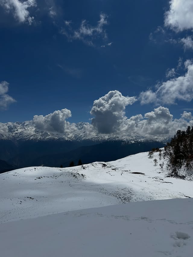
This is the version most people mean when they search “dayara bugyal winter trek” or “dayara bugyal snow trek.” Winter here means real snow – 6 to 10 feet of it at the meadow, with night temperatures dropping to -10°C to -15°C. It’s one of the more forgiving winter treks in the region precisely because the base camp altitude is manageable, but that doesn’t mean it’s casual. Microspikes or crampons are needed for the Bakaria Top push, and it’s genuinely a trek you want a certified operator for – not a solo winter attempt if you’re new to snow trekking.
Fair warning, though: winter also means the final climb gets steeper and the snow gets deeper the closer you get to the top, and the trek’s difficulty rises “by a notch” in these conditions, per Indiahikes’ own assessment.
Dayara Bugyal Trek Itinerary (Indiahikes 6-Day Version)
Most operators run some version of this structure – a drive day at each end, four days of actual trekking.
| Day | Route | Distance | Altitude |
| 1 | Dehradun → Raithal (drive) | 185 km, ~9 hours | 7,142 ft |
| 2 | Raithal → Gui | 4.5 km, ~5 hours | 7,142 ft → 9,630 ft |
| 3 | Gui → Chilapada | 2.5 km, 2–3 hours | 9,630 ft → 10,515 ft |
| 4 | Chilapada → Nayata via Dayara Top | 9.5 km, 6–7 hours | 10,515 ft → 11,830 ft → 9,186 ft |
| 5 | Nayata → Raithal | 4 km, 4–5 hours | 9,186 ft → 7,142 ft |
| 6 | Raithal → Dehradun (drive) | 185 km, ~8 hours | – |
Shorter 4-day, 3-night packages exist too – Thrillophilia runs a 4-day, 3-night version with Dehradun pick-up and drop-off – usually by compressing the drive and trek days into fewer overnight stops. If you’re short on leave days, ask the operator exactly which campsites their compressed version skips before booking; that’s the detail that actually changes the experience.
How Difficult Is the Dayara Bugyal Trek?
Genuinely, this is where the trek earns its “great for beginners” reputation. Among high-altitude treks that go over 11,000 feet, Dayara Bugyal poses the least risk, according to Indiahikes, which is precisely why it gets recommended to first-timers, families, and people starting to trek later in life.
There are two stretches that actually test you:
- The first kilometre out of the base village – steep, well-laid trail, but it tests your stamina early.
- The final climb to Dayara Top – also steep, and it turns genuinely challenging once snow is involved, since the surface freezes hard overnight.
Fitness-wise, operators typically want you able to jog or walk 5 km in under 40 minutes before signing up – not an elite bar, but not nothing either. Minimum age tends to sit around 8, and several operators happily take trekkers well past 58 with a basic cardiac clearance.
Dayara Bugyal Trek Cost
Budgets vary by operator, inclusions, and season, and prices shift year to year – so treat any number here as a starting reference, not a quote. As one data point, Indiahikes lists its trek fee at ₹11,950 (plus 5% GST), Raithal to Raithal, with a mandatory ₹180 insurance fee and optional ₹2,600 round-trip transport from Dehradun. On top of that, offloading your backpack to a mule or porter costs an additional ₹1,600 plus GST, and it’s generally reserved for trekkers with a genuine physical limitation rather than a default add-on.
What typically gets included, and what doesn’t, differs by operator – some bundle transport and gear rental, others charge separately. The honest move here is to ask each operator for a full inclusions list before comparing headline prices, since a “cheaper” package can end up costing more once transport, permits, and gear rental are added back in.
Raithal vs Barsu: Which Base Village to Pick?
| Factor | Raithal | Barsu |
| Starting altitude | ~1,800 m | ~2,400 m |
| Trail character | Longer, more varied forest walk, better acclimatisation | Shorter climb, suits experienced trekkers with less time |
| Homestay options | More homestay options; Indiahikes’ primary base camp | Fewer, quieter |
| Best for | Beginners, families, first-time high-altitude trekkers | Trekkers on a tight schedule who’ve done a Himalayan trek before |
Most first-timers end up at Raithal, and it’s a reasonable default – more support infrastructure, an easier acclimatisation curve, and a longer forest stretch that eases you into the altitude gain rather than throwing it at you all at once.
Dayara Bugyal vs Kedarkantha: Which Should You Pick?
Both are beginner-friendly winter snow treks in the same general region, which is exactly why they get cross-shopped constantly. The short version: Kedarkantha climbs to a proper summit with a 360-degree peak view; Dayara Bugyal is a rolling meadow experience with a gentler overall gradient and, generally, fewer crowds during peak winter weekends. If a defined “summit moment” matters to you, Kedarkantha wins that comparison. If you’d rather spend a full day wandering open grassland with mountain views on every side, Dayara Bugyal is the better fit. Neither is objectively harder – they’re just different flavors of “easy Himalayan trek.”
A Word on Safety
It’s worth being direct about something that’s been in the news recently. In late May 2026, a 30-year-old trekker went missing near the Goi (Gui) campsite during a Dayara Bugyal trek, and as of late June, search teams – including SDRF, the Disaster Management Department, the Army, and ITBP – had not located her despite an extensive operation that included draining the nearby lake. Uttarakhand’s Tourism Department subsequently cancelled the registration of the trekking agency involved and recommended a permanent ban, citing serious negligence.
This isn’t mentioned to alarm anyone – Dayara Bugyal remains one of the more accessible treks in the Garhwal Himalayas, and incidents like this are rare. But it’s a real reminder to book only through registered, well-reviewed operators, stick with your group after dark, and avoid wandering off from camp alone at night, snow trek or not.
Frequently Asked Questions
Is the Dayara Bugyal trek open right now?
Yes, except during the monsoon months, the trek runs nearly year-round. Always confirm current trail and weather status with your chosen operator before travel, since access can shift with government permit restrictions or road conditions.
How many days does the Dayara Bugyal trek take?
Typically 4 trekking days, 6 days total once you include the drive from and back to Dehradun. Some operators compress this to 4 days, 3 nights total.
Is Dayara Bugyal good for beginners?
Yes – it’s rated the least risky trek among those crossing 11,000 ft, and is regularly recommended for families and first-time trekkers.
What is the minimum age for this trek?
Most operators set 8 years as the minimum, provided the child is physically fit.
Will there be network coverage on the trek?
Mobile network is available across most of the trek, including at Dayara Top, though it shouldn’t be relied on for work commitments.
How This Guide Was Researched
This is a researched, aggregated guide rather than a first-hand trek report. Figures on distance, altitude, temperature, itinerary, and cost were cross-checked against official trek operator pages (primarily Indiahikes’ published itinerary, since it’s the most detailed and internally consistent), independent trek-blog write-ups, and recent regional news coverage for the safety section. Where sources gave conflicting numbers – which happens often on this trek, since “distance” and “altitude” get measured differently by different operators – that disagreement is shown directly in the comparison tables rather than resolved by picking whichever number sounded most authoritative.
Sources
- Indiahikes – Dayara Bugyal Trek (official itinerary, cost, and FAQs)
- The Daily Jagran – Uttarakhand Trek Mystery: Goi Lake drained, search expands
- JustWravel – Dayara Bugyal Trek Map: Route, Distance & Elevation Guide

Travel Writer | Founder of Welcome Uttarakhand
Amit Negi has been exploring Uttarakhand’s temples, trekking routes, hill stations, and hidden villages for several years. Through Welcome Uttarakhand, he shares practical travel guides, local insights, and itinerary tips to help visitors plan memorable trips across the state.