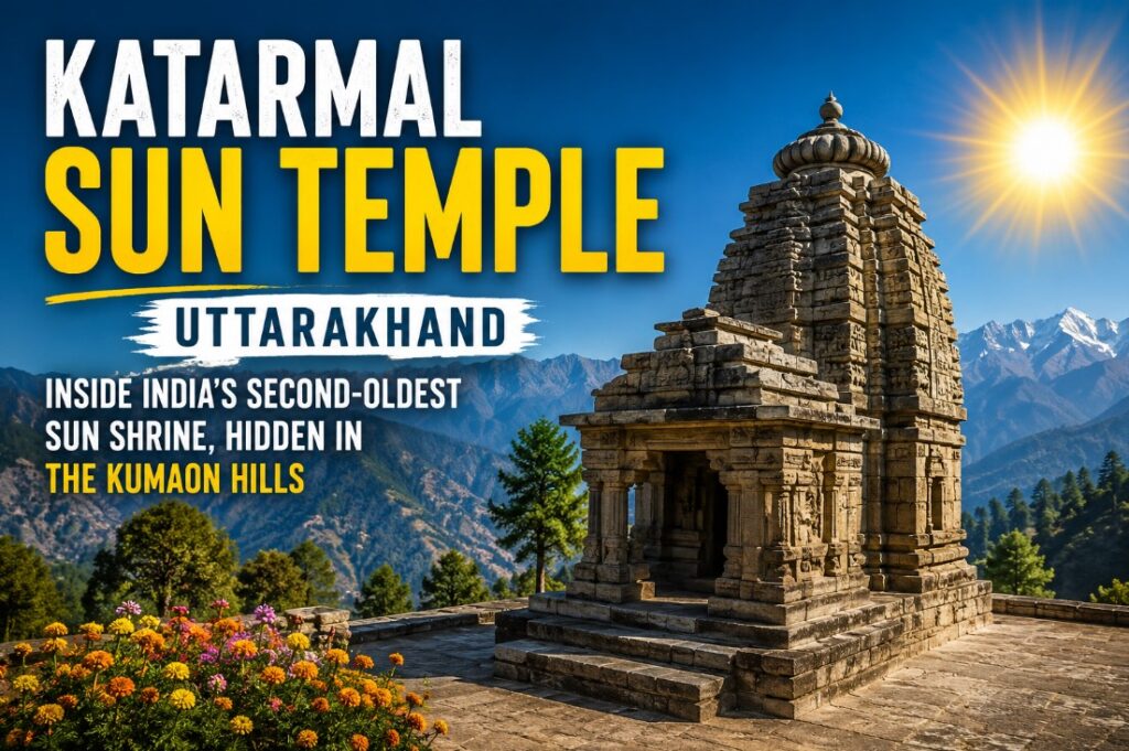
Twice a year, on mornings in late February and late October, the first light of the sun climbs over the Kumaon ridgeline and lands directly on a stone idol inside a crumbling temple complex above the Kosi river. No priest times it. No mechanism aims it. A group of 9th-century builders worked it out with nothing but stone, sightlines, and patience – and it still works, over a thousand years later.
That temple is Katarmal, and most people who’ve heard of Indian sun temples know exactly one: Konark, in Odisha. Katarmal rarely gets mentioned in the same breath, despite regularly being called the second-most significant Sun Temple in the country. Here’s what it actually is, why it was built where it was, and what to know before making the trip.
Who Built It, and When
Local sources credit the temple’s construction to Katarmalla, a king of the Katyuri dynasty, which ruled over the Kumaon region during the early medieval period. Most tourism and heritage write-ups date the temple to the 9th century.
Worth flagging: a few sources describe it simply as “more than 800 years old,” which would place construction closer to the 12th century rather than the 9th. That’s a real discrepancy, not a rounding error – a 300-year gap matters when you’re talking about a heritage monument. The 9th-century dating appears more consistently across sources, including tourism boards, so treat that as the stronger claim, but the age isn’t settled with total precision.
The main deity is Surya, worshipped here under the name Vraddhaditya – sometimes written as Vriddhaditya or Burhadita, roughly “the old sun god” or “great sun god.” Shiva-Parvati and Lakshmi-Narayan idols are also housed within the complex, alongside the primary shrine.
The Legend Behind the Site
Folklore tied to the temple tells of a demon named Kaalnemi who was tormenting sages performing penance near the Kosi river. The sages prayed to Surya for help. Pleased with their devotion, the sun god is said to have channeled his energy into a sacred stone – a Vat Shila – and used it to destroy the demon. King Katarmal later built the temple on that exact spot to mark the event.
Take that as folklore, not history. But it’s the kind of detail that explains why a sun temple ended up on a remote hilltop rather than in a more accessible location – origin stories for temple sites in this region often anchor to a specific natural feature or event, and this one’s no different.
The Architecture – And Why It’s Falling Apart
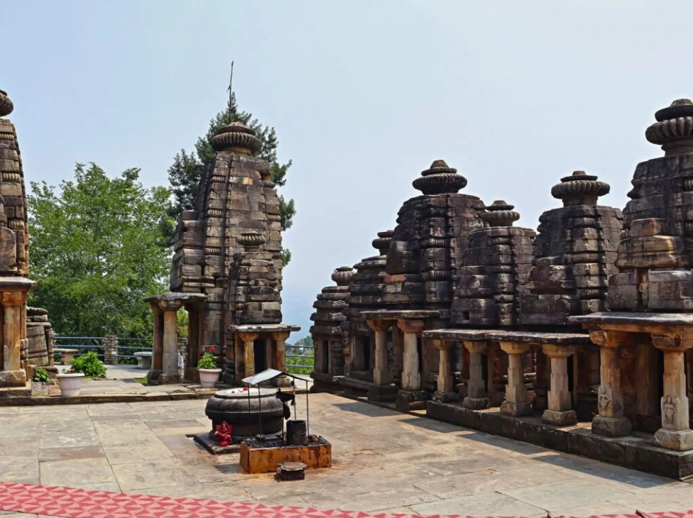
The temple was built almost entirely from stone, using a lime-and-lentil-paste mortar instead of modern cement – an adhesive that, by most accounts, has held the stones together for centuries with only recent conservation work. The main shrine is surrounded by roughly 45 smaller subsidiary shrines, arranged in tight clusters, giving the whole site a maze-like layout rather than one grand structure.
The wooden doors and panels were, by most accounts, exceptional – detailed enough to be ranked just below Konark’s carvings in craftsmanship. That didn’t last. After a 10th-century idol was stolen from the temple, the original carved wooden doors and panels were removed and relocated to the National Museum in Delhi, where they remain today. What’s left on-site is largely stone: carved pillars, wall reliefs, and the black, unpainted exterior that gives Katarmal a starker look than the brightly painted temples nearby, like Kasar Devi.
The Archaeological Survey of India now maintains the site and has carried out repair work in recent years, though several visitor accounts still describe it as partially in ruins. That’s part of its character, honestly – this isn’t a polished, restored monument built for tour buses.
Getting There: What the Distance Actually Is
Here’s where sources genuinely disagree, and it’s worth showing rather than picking one number and hoping nobody checks.
| Source | Distance from Almora |
| Almora District Government site | ~17 km |
| Holidify | 19 km |
| eUttaranchal | 19 km |
| Nainital Corbett Tourism | 7 km |
| Tripadvisor (visitor account) | 12 km |
The safest bet: plan for somewhere in the 17–19 km range from Almora town, and don’t be surprised if a local quotes something different – hill-road distances vary depending on the exact route taken.
Multiple accounts agree that vehicle access stops well short of the temple. After crossing the Kosi river near Kosi village, visitors need to walk anywhere from 1.5 to 3 km on foot through a few small villages before reaching the temple complex. It’s not a technical trek, but there are no shops along the way, so carry water.
By air: Nearest airport is Pantnagar, roughly 125–142 km away depending on the source, followed by a taxi to Almora and on to Katarmal.
By train: Nearest railway station is Kathgodam, about 90 km out, connected directly to Delhi, Lucknow, and Dehradun.
By road: Almora is well connected to Nainital, Ranikhet, and Haldwani, and most people drive or taxi from there.
Temple Timings – Another Point of Disagreement
| Source | Reported Timings |
| Trawell | 9 AM – 6 PM |
| The Travel Curry | 6 AM – 6 PM |
Given the sunrise-alignment phenomenon that draws people here in the first place, an early opening time makes more intuitive sense – but confirm locally or with the Almora tourism office before planning an early trip around it, since one source’s 9 AM opening would rule out catching sunrise entirely.
Best Time to Visit
Two separate claims circulate about when the sun-alignment phenomenon happens:
- One set of sources says the effect is best seen broadly across November to February
- Another gets specific and names February 22 and October 22 as the exact days the first rays hit the idol directly
Both can’t be fully precise at once. If the alignment is genuinely tied to specific solar declination angles (which is plausible, given how these ancient astronomical temples were usually designed), the exact-date claim is more likely to be technically accurate, with the broader Nov–Feb window describing when the lighting is generally dramatic even if not perfectly aligned. Anyone traveling specifically to see this should double-check current dates locally rather than relying on either source blindly.
Outside of the alignment question, March to November is generally recommended, with the rainy season (roughly July–September) best avoided due to landslide risk on the approach roads. Average temperatures hover around 17–20°C, so pack a light jacket even in the warmer months.
Why It Matters Beyond Konark Comparisons
It’s easy to reduce Katarmal to “the other sun temple,” but that undersells it. It’s reportedly the only sun temple built at this elevation in the Himalayan foothills – over 2,100 meters up – which is a genuinely different engineering problem than building on flat coastal land like Konark. Getting a precise solar alignment right on uneven mountain terrain, using 9th-century tools, is not a small feat.
There are only five sun temples of real historical note in India: Konark (Odisha), Katarmal (Uttarakhand), Modhera (Gujarat), Martand (Jammu & Kashmir), and Osian (Rajasthan). Katarmal is the only one of the five sitting in the mountains.
Frequently Asked Questions
Who built Katarmal Sun Temple?
King Katarmalla of the Katyuri dynasty, most commonly dated to the 9th century.
Why are the original wooden doors not at the temple anymore?
After a 10th-century idol theft, the carved wooden doors and panels were moved to the National Museum, Delhi, for preservation.
Is Katarmal really India’s second-most-important sun temple?
That’s the widely repeated claim across tourism sources, largely based on the intricacy of its original carvings and its historical significance, ranked just behind Konark.
Do you need to trek to reach it?
Yes – vehicle access ends near the Kosi river, and visitors walk roughly 1.5–3 km on foot through nearby villages to reach the temple.
What deities are worshipped there?
The primary deity is Surya, called Vraddhaditya. The complex also houses Shiva-Parvati and Lakshmi-Narayan idols.
How This Guide Was Researched
This guide was compiled from official tourism and district government listings, established regional travel guides, and on-ground visitor accounts and reviews. Where sources gave conflicting figures – distance, timings, or the exact alignment dates – that disagreement is shown directly rather than smoothed over, so readers can verify locally before traveling.

Travel Writer | Founder of Welcome Uttarakhand
Amit Negi has been exploring Uttarakhand’s temples, trekking routes, hill stations, and hidden villages for several years. Through Welcome Uttarakhand, he shares practical travel guides, local insights, and itinerary tips to help visitors plan memorable trips across the state.